
Start a Conversation
Bee2Fire Forest
Forest-scale fire detection
that never sleeps.
Protecting forest plantations, natural parks, and nature reserves across 3 continents. Our multi-sensor AI platform detects smoke at 15 km before it becomes a crisis.
Scroll
1 %
Detection Rate
1 km
Range
0 min
Alarm Time
1×7
Operation
Capabilities
8 core detection capabilities.
Every Bee2Fire Florestal deployment combines eight detection capabilities into a single managed platform.
Multi-Spectral Detection
Optical, thermal, and spectrometric sensors in simultaneous operation — fusing all three data streams for definitive ignition classification.
Smoke Column Detection
AI identifies smoke columns at distances up to 15 km with sub-pixel precision — triggering alerts before the fire has time to spread beyond the ignition point.
Dual AI Consensus
Two independent classifiers must agree before raising an alarm — eliminating false positives caused by weather phenomena, dust, or industrial haze.
Pan-Tilt Coverage
360° coverage from a single vantage point with automated tracking of detected anomalies — the system steers itself toward any thermal or smoke signature.
Night Operation
LWIR thermal imaging maintains full detection capability in complete darkness and low-visibility conditions — 24 hours a day, every day of the year.
False Alarm Filtering
Weather phenomena, dust clouds, industrial steam, and vehicle exhaust are automatically filtered before any alert reaches the operator console.
Real-Time Alerts
Sub-3-minute ignition-to-alert pipeline with configurable operator escalation protocols — SMS, email, API push, and dashboard notification in parallel.
Remote Monitoring
Centralised operator console with live camera feeds, alarm management, geofenced event mapping, and exportable audit logs for regulatory reporting.
Detection Stack
Three sensor layers.
One AI brain.
Each modality targets a different fire signature. Together, the fused output is the most reliable early-detection system available for forest environments at any scale.
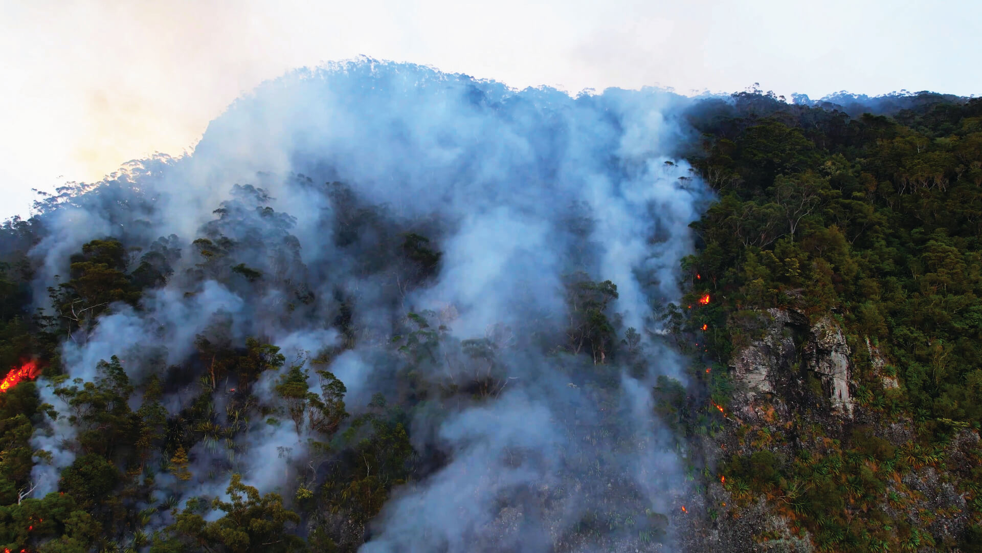
Optical
High-resolution pan/tilt cameras with 30× zoom, detecting smoke columns at long range with sub-pixel smoke detection algorithms optimised for forest backgrounds.
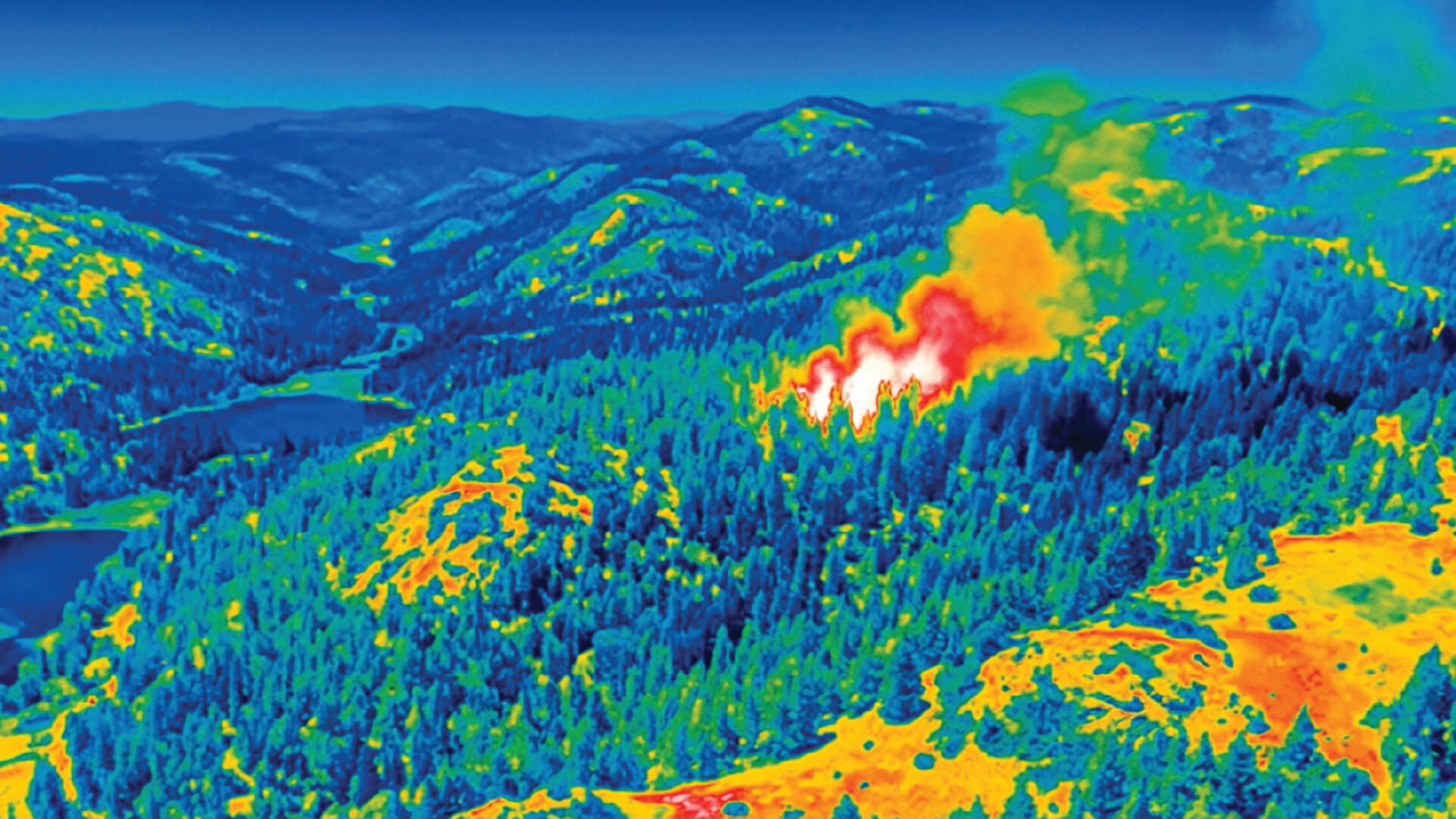
Thermal
LWIR thermal arrays capturing heat signatures invisible to the naked eye, operating day and night in all weather conditions with continuous perimeter temperature mapping.
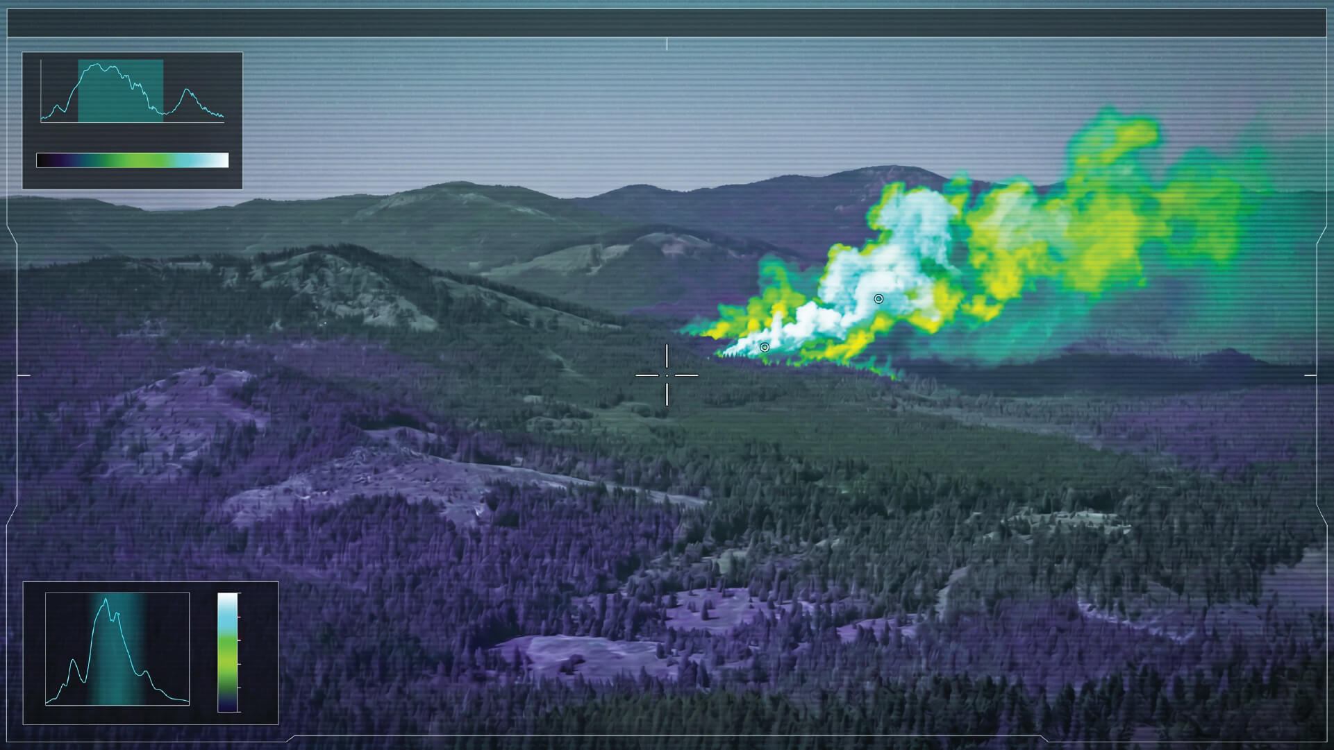
Spectrometry
Multi-spectral sensors identify chemical signatures in smoke plumes — the earliest warning layer in the detection stack.
System Architecture
From sensor to action
in under 3 minutes.
The Bee2Fire pipeline is engineered for speed and reliability. Every detection passes through four validated stages before an alarm reaches the operator.
Step 01
Capture
Multi-sensor arrays continuously stream video at 30fps across all spectral channels — optical, thermal, and spectrometric — with zero gaps in spatial or temporal coverage of the protected perimeter.
Step 02
Classify
Dual deep learning models process all streams in parallel, independently classifying smoke, flame, and gas signatures in real time. Each model was trained on millions of real-world forest fire frames across diverse terrain types.
Step 03
Validate
The dual-consensus engine cross-validates detections between both classifiers and across all sensor modalities — eliminating single-sensor false positives before any alert is issued to operators.
Step 04
Alert
Confirmed alarm is routed to the centralised operator console and client portal within 3 minutes of ignition. GPS coordinates, camera snapshot, and sensor confidence scores are attached automatically.
How It Works
Define. Detect. Predict.
Define
Perimeter Definition
Boundary intelligence from satellite & field data
Define protected zones with precision using multi-layer geospatial data — satellite imagery, cadastral boundaries, topography, and vegetation maps. Bee2Fire operators configure detection perimeters to your exact terrain and infrastructure, ensuring zero blind spots across your entire protected area.
360°
Coverage
24×7
Operator Support
Key Capabilities
Satellite-assisted perimeter mapping
Multi-sensor placement optimisation
Terrain and vegetation analysis
Coverage gap identification
Integration with existing GIS systems
Detect
Automatic Detection
Alarm at the moment of ignition
Deep learning models run in parallel across optical, thermal, and spectrometric camera feeds. Dual AI classifier consensus eliminates false alarms and delivers sub-3-minute notification from ignition to alert.
>95%
Detection Rate
<3 min
Ignition to Alarm
24×7
Unmanned Ops
Key Capabilities
Dual AI classifier consensus
<3 min from ignition to alarm
Multi-sensor fusion
24×7 unmanned operation
Predict
Fire Propagation
Guide resources before the fire expands
Estimates the expected spread of the fire on the terrain up to 24 hours ahead — factoring wind speed, terrain slope, and fuel type to produce decision-support reports your commanders can act on.
3 min
Perimeter Estimation
120 min
Forecast Window
98 %
Model Accuracy
24h
Forecast Window
Key Capabilities
Propagation model with terrain inputs
Wind & slope modelling
Decision-support reports
Resource allocation guidance
Start a Conversation
Talk to us about
your project.
Tell us about your terrain and we will design a detection architecture around your specific needs — no commitment required.
TECHNICAL ASSESSMENT
Site-specific detection architecture design
LIVE DEMO
See the platform operating on real data
Ready to protect your forest?
Schedule a site assessment with our detection architects. We’ll design a coverage architecture tailored to your terrain, vegetation type, and operational requirements.